

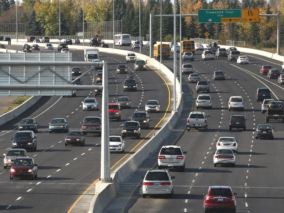
The study will assess how to improve congestion-prone areas and collision hot spots along Glenmore Trail
The city is carrying out a functional planning study for Glenmore Trail between Richard Road and 14th Street S.W. in a bid to alleviate congestion and make the busy corridor safer. The section of the 80-kilometre-an-hour freeway up for review separates the southwest communities of Lakeview, Garrison Green and North Glenmore. The area of study also includes the bridge that crosses the Glenmore Reservoir, known as the Glenmore Causeway.
Glenmore Trail, which becomes Highway 8 outside of city limits, is the only continuous east-west corridor across central Calgary and one of the city’s most travelled freeways, according to a city webpage devoted to the study. “Glenmore Trail is a critical east-west route for commuters, goods movement, transit and for nearby communities, and this stretch of Glenmore is carrying about 150,000 vehicles per day,” said Zeeshan Abdy, a senior transportation planner for the City of Calgary. “Even a small operational issue can have a big impact on travel reliability.”
The study, which began with community engagement last month and will continue until next summer, will assess how to improve congestion-prone areas and collision hot spots along Glenmore Trail, particularly the interchanges for 14th Street and Crowchild Trail. “Along Glenmore Trail, we have challenges with respect to sudden speed changes, weaving movements, merging challenges and condition-related issues,” Abdy said. “These conditions can increase the risk of collisions, particularly near ramps and during busy travel periods.”
The city will also study the trail’s environmental constraints, Glenmore Dam and water treatment plant operations, drainage and utility impacts, bridge requirements, and property impacts. It will also consider regional pathways, transit facility connections, future growth potential and emergency services access, including to the Rockyview General Hospital. ‘Something needs to be done there,’ says councillor Ward 11 Coun.
Rob Ward said Glenmore Trail has become one of Calgary’s highest-risk roads, in terms of collisions. “Also, there’s congestion issues, being that it is such a high-use road, so, I believe the city’s looking at how to make it safer and how to make it more efficient for travellers as well,” he said. Most of the collisions on Glenmore occur when vehicles come onto or off the Crowchild/Glenmore overpass, as well as on the eastbound causeway, before the two right-hand lanes turn into 14th Street S.W., Ward added.
“So something needs to be done there,” he said. “I’m not sure if it can be done without expansion (of the causeway), but whatever the right solution is, that’s what I’m in favour of.” ‘We’re planning now so future improvements are ready,’ says transporation planner The city’s goal is to determine short- and long-term design upgrades to make Glenmore Trail safer and alleviate congestion, Abdy said, particularly at intersections and interchanges.
He said that focus of the study will begin next year. Options could include widening the roadway, widening the Glenmore Causeway, adding future high occupancy vehicle lanes, or building a new interchange at Richard Road. The stretch of Glenmore Trail between 37th Street S.W. and Crowchild Trail was recently widened from four to six lanes , with work happening between 2018 and 2021.
That project also included upgrades to the Glenmore Trail/Crowchild Trail interchange and a new pedestrian bridge over Crowchild Trail at 54th Avenue S.W. Implementation of whatever recommendations emerge from the current study will depend on future budget support, Abdy added. “Our key message is that we’re planning now so future improvements are ready when funding and council approval are in place,” he said. “We do foresee a future growth of Glenmore Trail based on the number of people coming to the city, as well as current residents trying different travel patterns.”
Calgarians can learn more about the Glenmore Trail study or submit online feedback at engage.calgary.ca/glenmorestudy . Catch up with the day’s headlines, curated by our editors and delivered to your email inbox at lunchtime on every business day. Sign up now for the Calgary Herald Noon News Roundup.
- Published
- Jul 15, 2026
- Updated
- Jul 15, 2026
- Source
- Calgary Herald
- Category
- Politics
- Read time
- 3 min
Key facts
Why this matters locally
This politics story matters locally because it may affect readers, businesses, commuters, families, or public services in British Columbia.
Local impact
BC Post links this item to British Columbia coverage so readers can follow related city updates, weather, traffic, events, and category news in one place.
Timeline
Source and credit
BC Post may summarize, organize, and add local context for reader clarity. Original reporting remains with the listed publisher.
Related Articles
View all Politics
Powerful pro-life ad featuring boxing legend to air during final World Cup matches
Politics
Powerful pro-life ad featuring boxing legend to air during final World Cup matches
 Politics
Vaughn Palmer: David Eby's slow and expensive step toward involuntary care
Politics
Vaughn Palmer: David Eby's slow and expensive step toward involuntary care
 Politics
Pitt Meadows to host information session for city council candidates
Politics
Pitt Meadows to host information session for city council candidates
 Politics
Hundreds of enthusiatic supporters attend Surrey Mayor Brenda Locke’s fundarising dinner
Politics
Hundreds of enthusiatic supporters attend Surrey Mayor Brenda Locke’s fundarising dinner
 Politics
One hundred affordable housing units for seniors coming to Sherbrooke
Politics
One hundred affordable housing units for seniors coming to Sherbrooke
 Politics
‘No consequences’: East Van woman says she was targeted by hate-motivated assault
Politics
‘No consequences’: East Van woman says she was targeted by hate-motivated assault
More Local Coverage
Latest news Business
AI Market Trends: Q2 2026 Review and Forecast
Business
AI Market Trends: Q2 2026 Review and Forecast
 Local News
Cowichan sports shorts: rugby, hockey, biking
Local News
Cowichan sports shorts: rugby, hockey, biking